Global S&T Development Trend Analysis Platform of Resources and Environment
| Earth from Space: Barranquilla, Colombia | |
| admin | |
| 2022-04-01 | |
| 发布年 | 2022 |
| 语种 | 英语 |
| 国家 | 欧洲 |
| 领域 | 地球科学 |
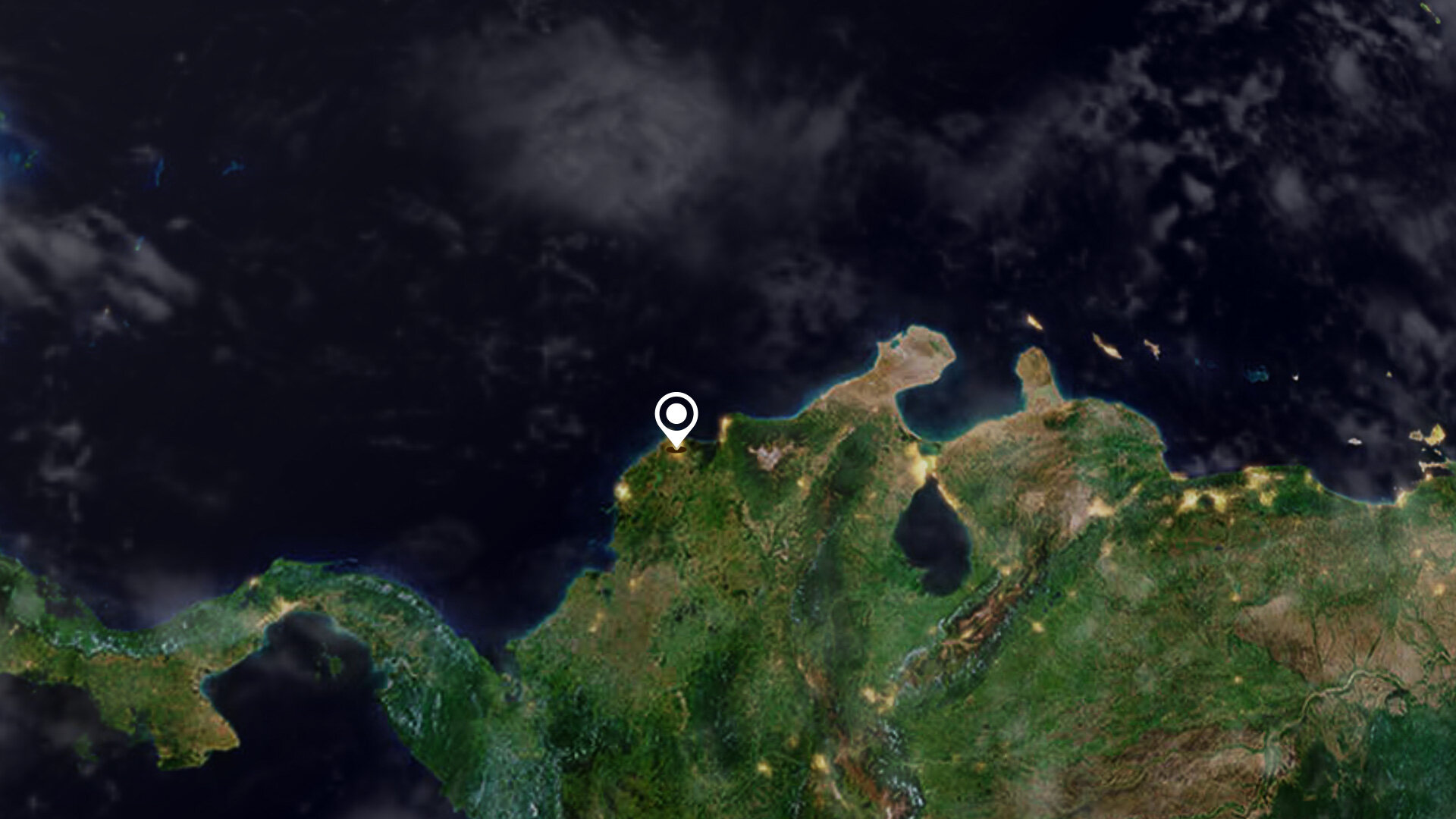
| 正文(英文) | Barranquilla, the capital of the Atlántico department in northwest Colombia, is featured in this image taken by the Copernicus Sentinel-2 mission. Click on the image below to explore it in its full 10 m resolution. 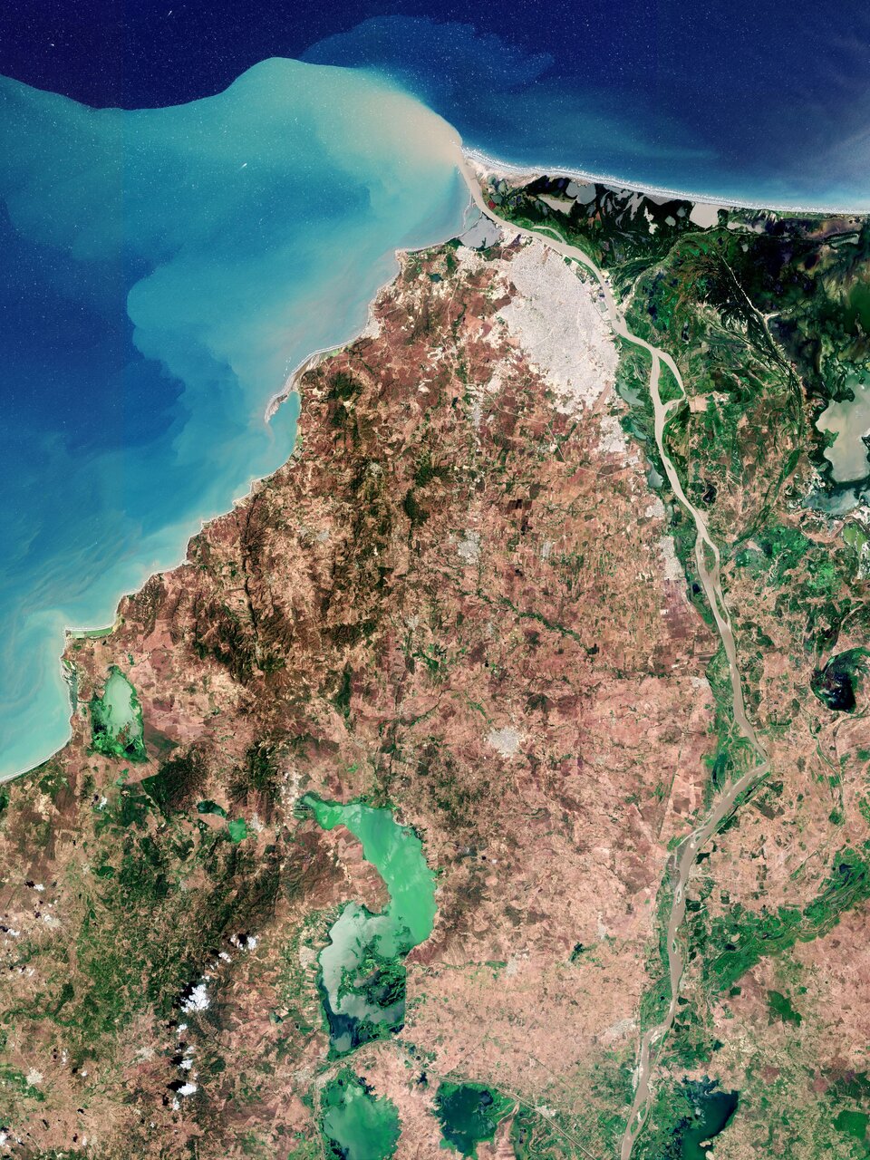
Barranquilla, visible in grey at the top of the image, covers an area of around 155 sq km and is the fourth-most populous city in Colombia after Bogotá, Medellín and Cali. The city of Barranquilla serves as a major trade centre for Colombia, housing the largest port along the Caribbean Sea. Thanks to this famous port, Barranquilla earned itself the nickname ‘Colombia's Golden Gate’ (or La Puerta de Oro de Colombia in Spanish). The city lies strategically next to the delta of the Magdalena River, one of the main rivers in Colombia, flowing northwards for around 1500 km through the west half of the country before emptying into the Caribbean Sea. Owing to large quantities of sediment, as seen by the extensive sediment plume at its mouth and the brownish colour of its waters, the Magdalena requires frequent dredging of its main channel to allow access to Barranquilla’s port for oceangoing vessels. This image, captured in March 2021, was taken just before the onset of the rainy season, which starts in April. The urban area of Barranquilla, with airport runways visible south of the city, contrasts with the Ciénaga Grande de Santa Marta swampy marshes to the east visible in dark green. Selected as a Ramsar Site of International Importance, the site is important for its mangrove ecosystem, which is the largest on the Caribbean coast of Colombia. It also serves as habitat and winter breeding ground for several bird species. Other notable features in the image include the El Guajaro Reservoir, around 50 km southwest of Barranquilla. The reservoir was created by the union of seven smaller swamps in the area to supply water for agricultural irrigation. In addition to sewage discharges, the reservoir receives agricultural runoff, particularly during the rainy season, which leads to states of eutrophication in the water that are accompanied by blooms of harmful microorganisms, otherwise known as cyanobacteria. These types of algae, which are commonly present in freshwater and saline ecosystems, are most likely why the lake appears in emerald green in today’s image. Satellite data from the Copernicus Sentinel-2 mission can track the growth and spread of harmful algae blooms in order to alert and mitigate against damaging impacts for tourism and fishing industries. The image is also featured on the Earth from Space video programme. 
Earth from Space: Barranquilla, Colombia
Access the video |
| URL | 查看原文 |
| 来源平台 | European Space Agency |
| 文献类型 | 新闻 |
| 条目标识符 | http://119.78.100.173/C666/handle/2XK7JSWQ/349009 |
| 专题 | 地球科学 |
| 推荐引用方式 GB/T 7714 | admin. Earth from Space: Barranquilla, Colombia. 2022. |
| 条目包含的文件 | 条目无相关文件。 | |||||
| 个性服务 |
| 推荐该条目 |
| 保存到收藏夹 |
| 查看访问统计 |
| 导出为Endnote文件 |
| 谷歌学术 |
| 谷歌学术中相似的文章 |
| [admin]的文章 |
| 百度学术 |
| 百度学术中相似的文章 |
| [admin]的文章 |
| 必应学术 |
| 必应学术中相似的文章 |
| [admin]的文章 |
| 相关权益政策 |
| 暂无数据 |
| 收藏/分享 |
除非特别说明,本系统中所有内容都受版权保护,并保留所有权利。


修改评论