Global S&T Development Trend Analysis Platform of Resources and Environment
| Pioneering North East project uses nature to reduce flood risk | |
| admin | |
| 2021-08-16 | |
| 发布年 | 2021 |
| 语种 | 英语 |
| 国家 | 英国 |
| 领域 | 资源环境 |
| 正文(英文) |
Press release
Pioneering North East project uses nature to reduce flood riskThe £2.1m government-funded Weardale Natural Flood Management scheme is led by the Environment Agency and is using nature based solutions to reduce flood risk. 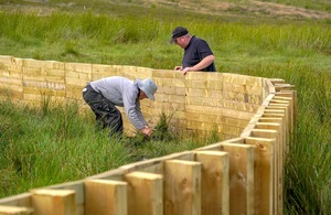
Construction takes place on one of the timber fences at the Killhope Burn More than 20 natural features have been constructed to bolster flood protection in the North East as part of a pioneering natural flood management project. The £2.1million government-funded Weardale Natural Flood Management scheme, which includes a series of nature based solutions such as storage areas, wooden leaky barriers and timber fences, could reduce flood risk across 41km2 to communities including Lanehead, Wearhead, Westgate and Stanhope. It’s also seen 150 hectares of peatland restored, will aim to create up to 75 hectares of woodland and brings a habitat boost to wildlife. The project is led by the Environment Agency working in partnership with Natural England, North Pennines AONB Partnership, the Forestry Commission and Durham County Council with representation from the Wear Catchment Partnership, alongside local farmers and landowners. This week (Thursday, 12 August) MP for North West Durham Richard Holden visited the site to find out more about the project. Leaky barriers and storage areasThe first set of features were completed by two landowners this summer on the Middlehope and Killhope Burns, with the next phase due to start in September. In total, they have the potential to store up to 5,150m3 of water – the capacity of more than two Olympic sized swimming pools. At Killhope Burn, 13 leaky dams have been built across the burn to restrict the flow of water and four timber fences constructed to slow the movement of water across the landscape At Middlehope Burn four storage areas have been created which will hold back water during heavy rain. By October, four more storage areas will be created. Further features will be built into the landscape next year as the project continues. The work explores reducing flood risk using natural flood management techniques to communities which have historically flooded due to water running from the surrounding hills. 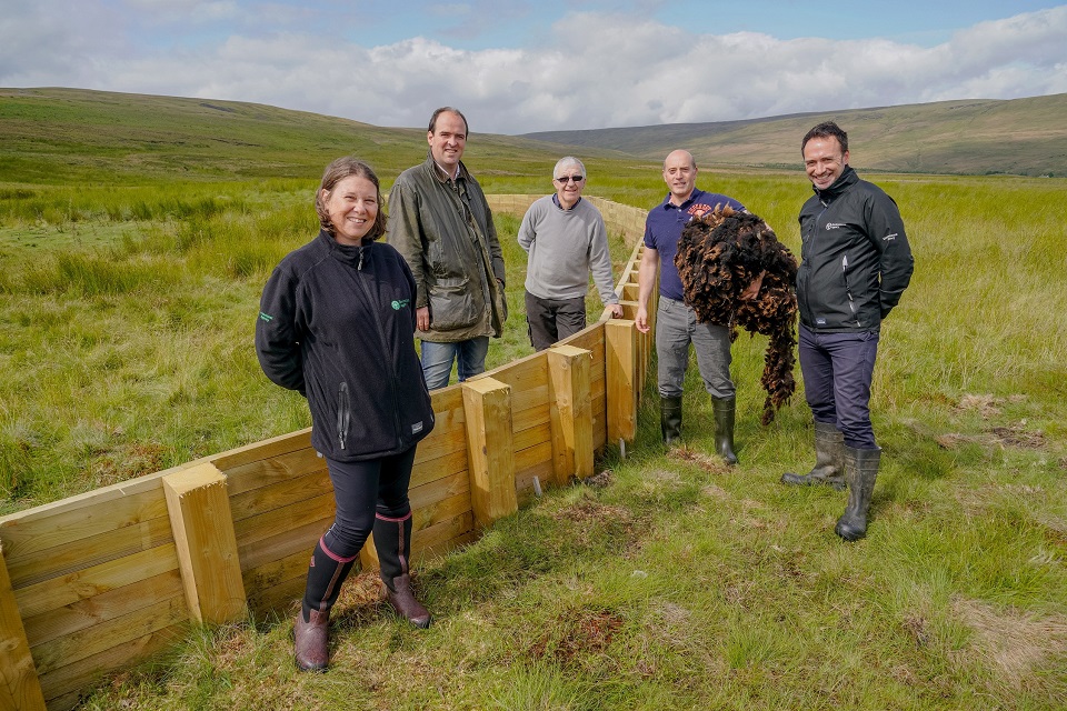 (L-R) Kirsty Hardy, Environment Agency; Richard Holden, MP for North West Durham; John Greenbank, part of the construction team; Greg Dalton, farmer and landowner; Jamie Fletcher, Environment Agency. Landowners play key roleKirsty Hardy, Environment Agency Project Manager, said:
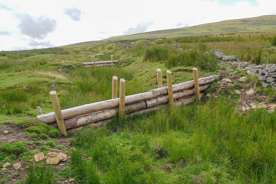 Leaky barriers on the Killhope Burn, which are designed to hold water back during heavy rainfall. Landowner Greg Dalton, who led on the construction of the features, added:
Changing the way floods are managedMP Richard Holden said:
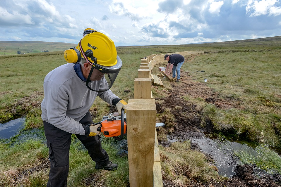 Construction taking place on one of the timber fences on the Killhope Burn. The latest work follows a demonstrator site which was completed in August 2019 and which stored 400m3 of flood water to protect communities from the impact of Storm Ciara in February 2020. A citizen science programme will monitor the features and feed into a range of projects to better understand flood risk management on a catchment scale. Sarah Tooze, Biodiversity Lead from the North Pennines AONB Partnership, said:
Published 16 August 2021
|
| URL | 查看原文 |
| 来源平台 | UK Environment Agency |
| 文献类型 | 新闻 |
| 条目标识符 | http://119.78.100.173/C666/handle/2XK7JSWQ/335740 |
| 专题 | 资源环境科学 |
| 推荐引用方式 GB/T 7714 | admin. Pioneering North East project uses nature to reduce flood risk. 2021. |
| 条目包含的文件 | 条目无相关文件。 | |||||
| 个性服务 |
| 推荐该条目 |
| 保存到收藏夹 |
| 查看访问统计 |
| 导出为Endnote文件 |
| 谷歌学术 |
| 谷歌学术中相似的文章 |
| [admin]的文章 |
| 百度学术 |
| 百度学术中相似的文章 |
| [admin]的文章 |
| 必应学术 |
| 必应学术中相似的文章 |
| [admin]的文章 |
| 相关权益政策 |
| 暂无数据 |
| 收藏/分享 |
除非特别说明,本系统中所有内容都受版权保护,并保留所有权利。


修改评论