Global S&T Development Trend Analysis Platform of Resources and Environment
| Marine habitat maps important for Antarctica’s biodiversity | |
| admin | |
| 2018-02-19 | |
| 发布年 | 2018 |
| 语种 | 英语 |
| 国家 | 英国 |
| 领域 | 资源环境 |
| 正文(英文) | The UK government is committed to the long-term protection of over four million km2 of the world oceans which fall within the UK’s Overseas Territories. Prioritising which parts of the ocean are most important to protect depends on scientific information to help decide upon the size and location of these marine protected areas (MPAs). However, many of the UK Overseas territories such as the sub-Antarctic island of South Georgia, famous for the great polar explorer Sir Ernest Shackleton’s expedition and more recently for stunning scenes from BBC’s Blue Planet 2, are very remote and have limited scientific data. Very often habitat maps made using large-scale physical environmental data (such as depth, submarine terrain and water temperature) are used to help predict patterns in marine biodiversity where biological records are either poor or lacking. A new publication in the journal Science of the Total Environment, from British Antarctic Survey, the National Oceanography Centre and University of Southampton, is the first attempt to see how well these large habitat maps help us understand the distribution patterns in the unique biodiversity of one of the world’s largest marine protected areas (1.07 million km2) at South Georgia. 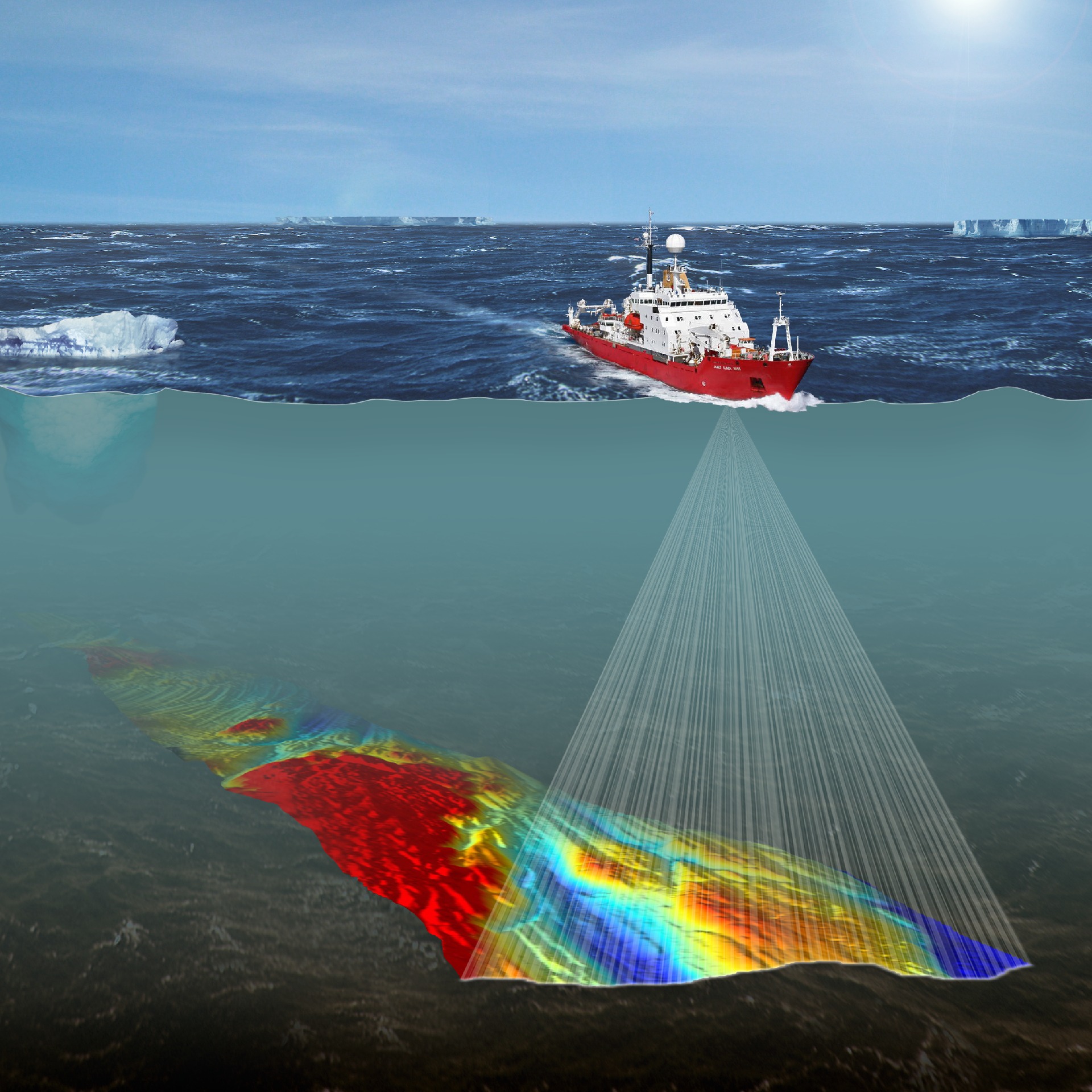 Lead author and marine ecologist Oliver Hogg, says:
The study found a distinct collection of marine animals associated with each of the different habitat regions, such as slow-growing cold-water corals found in complete darkness at depths of over a thousand metres and basket stars, a close relative of the starfish, which have spaghetti-like arms to grasp at food in South Georgia’s nutrient-rich waters. Regions sharing similar environmental conditions were shown to share more of the same species than regions with contrasting condition. This means that on very-large scales, habitat mapping could be meaningfully used to assist with planning and conservation in this important fisheries region. It could also be a useful tool for other areas of the World that do not have enough available biological data. Oliver Hogg concludes:
Read the paper here. |
| URL | 查看原文 |
| 来源平台 | British Antarctic Survey |
| 文献类型 | 新闻 |
| 条目标识符 | http://119.78.100.173/C666/handle/2XK7JSWQ/233803 |
| 专题 | 资源环境科学 |
| 推荐引用方式 GB/T 7714 | admin. Marine habitat maps important for Antarctica’s biodiversity. 2018. |
| 条目包含的文件 | 条目无相关文件。 | |||||
| 个性服务 |
| 推荐该条目 |
| 保存到收藏夹 |
| 查看访问统计 |
| 导出为Endnote文件 |
| 谷歌学术 |
| 谷歌学术中相似的文章 |
| [admin]的文章 |
| 百度学术 |
| 百度学术中相似的文章 |
| [admin]的文章 |
| 必应学术 |
| 必应学术中相似的文章 |
| [admin]的文章 |
| 相关权益政策 |
| 暂无数据 |
| 收藏/分享 |
除非特别说明,本系统中所有内容都受版权保护,并保留所有权利。


修改评论