Global S&T Development Trend Analysis Platform of Resources and Environment
| Earth from Space: Patagonia | |
| admin | |
| 2022-07-01 | |
| 发布年 | 2022 |
| 语种 | 英语 |
| 国家 | 欧洲 |
| 领域 | 地球科学 |
| 正文(英文) | The Copernicus Sentinel-3 mission captured this impressive, wide-angled view of Patagonia at the southern end of South America, as well as the Falkland Islands (Malvinas). Click on the image below to explore it in its full resolution. 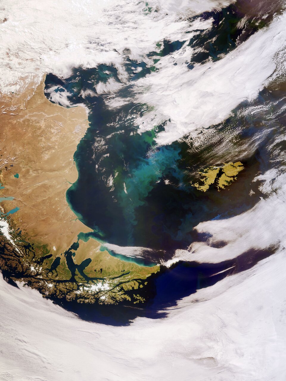
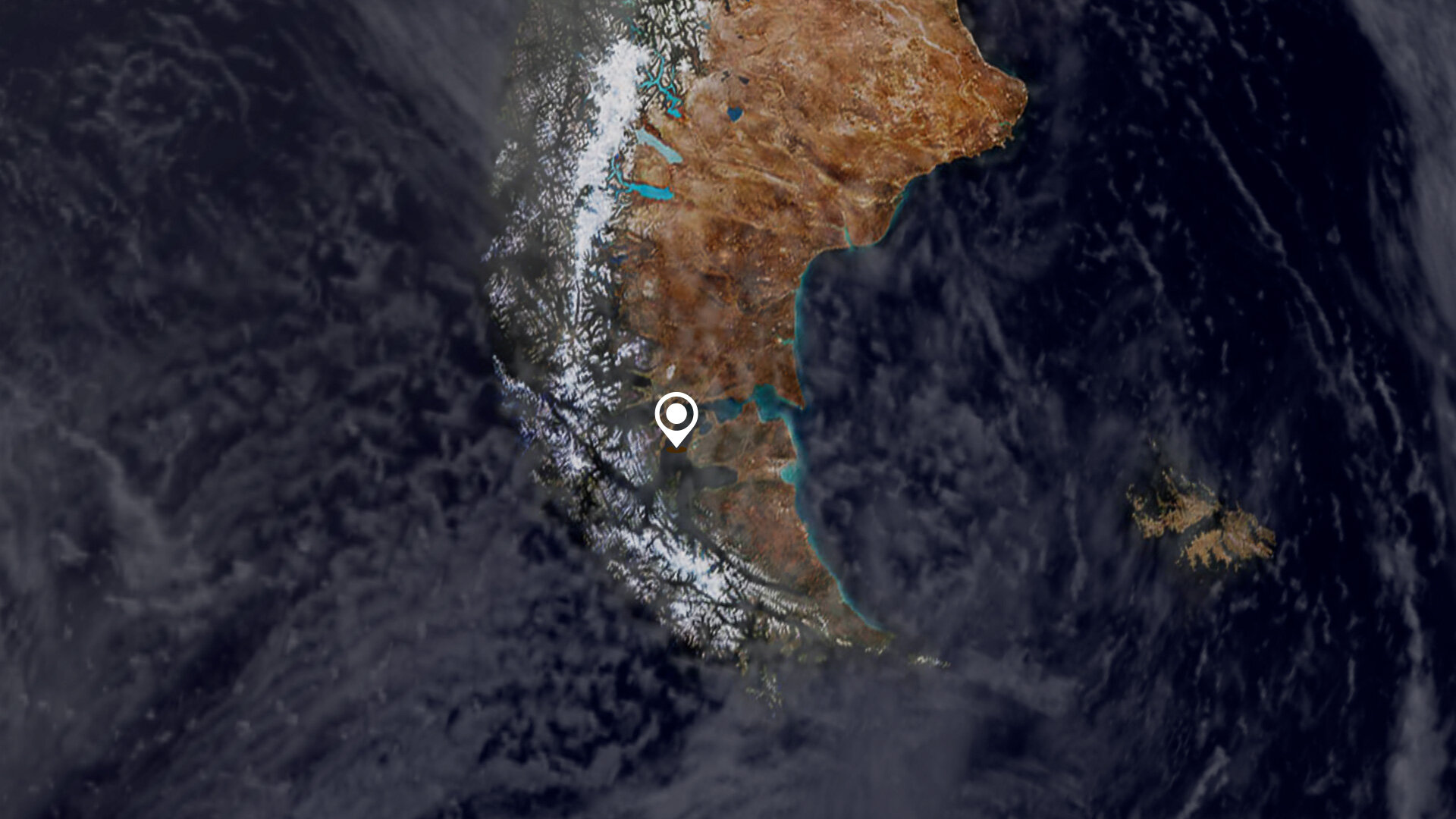
Covering an area of around 673 000 sq km, Patagonia is split by Argentina and Chile. The region comprises the southern section of the Andes Mountains, with lakes, fjords, rainforests and glaciers in the west and deserts and tablelands to the east. The island archipelago of Tierra del Fuego, located at the southern tip of Patagonia (the southernmost tip of the image), is shared by Argentina and Chile, with the eastern part of the main island belonging to Argentina and the southern point of the archipelago, which forms Cape Horn, belonging to Chile. The Strait of Magellan, named after the discoverer, lies between Tierra del Fuego and mainland Argentina. Part of the Alberto de Agostini National Park can be seen in the bottom of the image. The park features a highly irregular coastline, which is deeply indented by fjords. Deemed a designated UNESCO Biosphere Reserve, the park has several tidewater glaciers and comprises the Gordon, Cook and Londonderry islands. The Falkland Islands can be seen in the far-right of the image. The islands lie in the South Atlantic Ocean, around 600 km east of Patagonia. The Falklands comprise two main islands, West Falkland and East Falkland, which are separated by the Falkland Sound – a channel that averages around 20 km in width. The swirling green and blue coloured areas are densely concentrated phytoplankton blooms. These microscopic organisms thrive in the cool, nutrient-rich waters between the coast of southern Argentina and the Falkland Islands. Nutrients carried by rivers promote phytoplankton growth, which may explain the plankton hugging the South American coastline in the image, as well as dust carried from Patagonia offshore which is then diffused on the ocean surface by strong westerly winds. In spring and summer, populations of algae in the South Atlantic often explode into enormous blooms – which float with the meandering ocean currents. Carrying a suite of cutting-edge instruments, Copernicus Sentinel-3 measures systematically Earth’s oceans, land, ice and atmosphere to monitor and understand large-scale global dynamics. Sentinel-3 measures the temperature, colour and height of the sea surface as well as the thickness of sea ice, while over land maps land, provides indices of vegetation state and measures the height of rivers and lakes. This image is also featured on the Earth from Space video programme. 
Earth from Space: Patagonia
Access the video |
| URL | 查看原文 |
| 来源平台 | European Space Agency |
| 文献类型 | 新闻 |
| 条目标识符 | http://119.78.100.173/C666/handle/2XK7JSWQ/352236 |
| 专题 | 地球科学 |
| 推荐引用方式 GB/T 7714 | admin. Earth from Space: Patagonia. 2022. |
| 条目包含的文件 | 条目无相关文件。 | |||||
| 个性服务 |
| 推荐该条目 |
| 保存到收藏夹 |
| 查看访问统计 |
| 导出为Endnote文件 |
| 谷歌学术 |
| 谷歌学术中相似的文章 |
| [admin]的文章 |
| 百度学术 |
| 百度学术中相似的文章 |
| [admin]的文章 |
| 必应学术 |
| 必应学术中相似的文章 |
| [admin]的文章 |
| 相关权益政策 |
| 暂无数据 |
| 收藏/分享 |
除非特别说明,本系统中所有内容都受版权保护,并保留所有权利。


修改评论