Global S&T Development Trend Analysis Platform of Resources and Environment
| Land use of Australia 2010-11 to 2015-16 | |
| admin | |
| 2022-06-22 | |
| 出版年 | 2022 |
| 国家 | 澳大利亚 |
| 领域 | 资源环境 |
| 英文摘要 | This website is an information hub to assist land managers, planners and others who need to know more about land use, land management practices and land cover data and information for Australia. It contains information about land use, land management practices and land cover mapping in Australia, access to national classification systems, technical reports supporting mapping work, and analysis of land information. This site provides access to downloadable data and the ability to view data using different analytical mapping tools. The Land Use and Management Information for Australia website is maintained by ABARES on behalf of the Australian Collaborative Land Use and Management Program (ACLUMP). 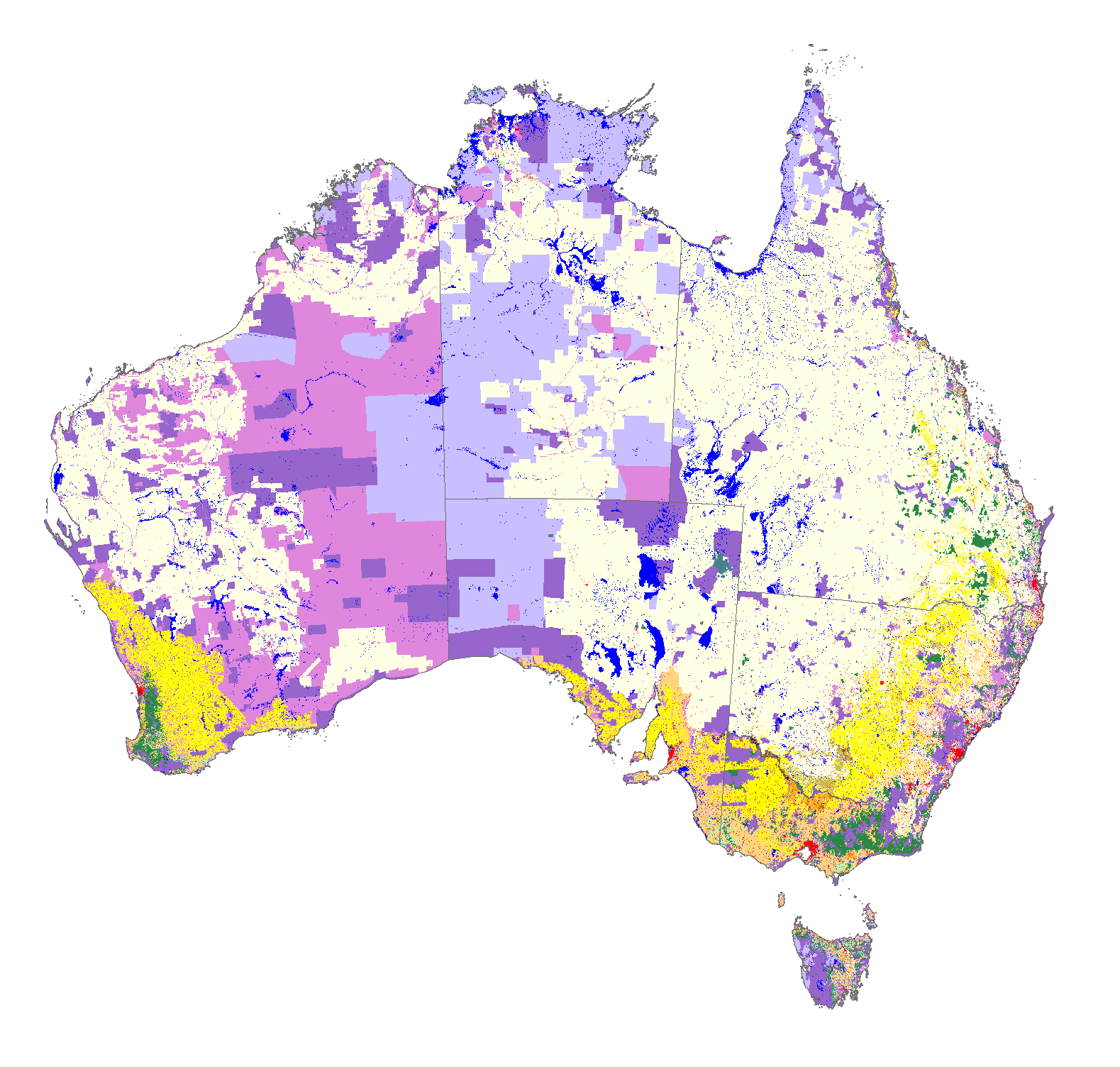 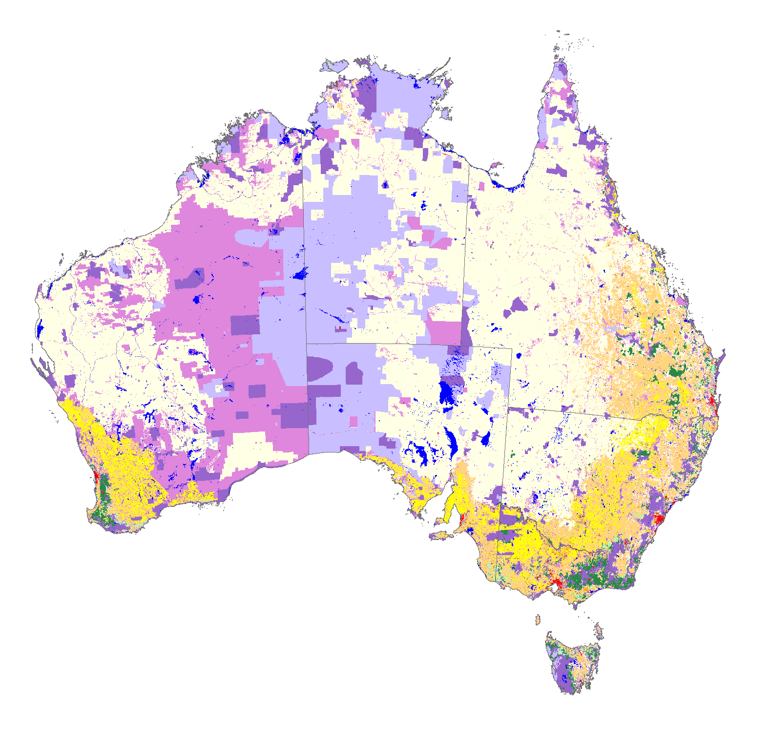
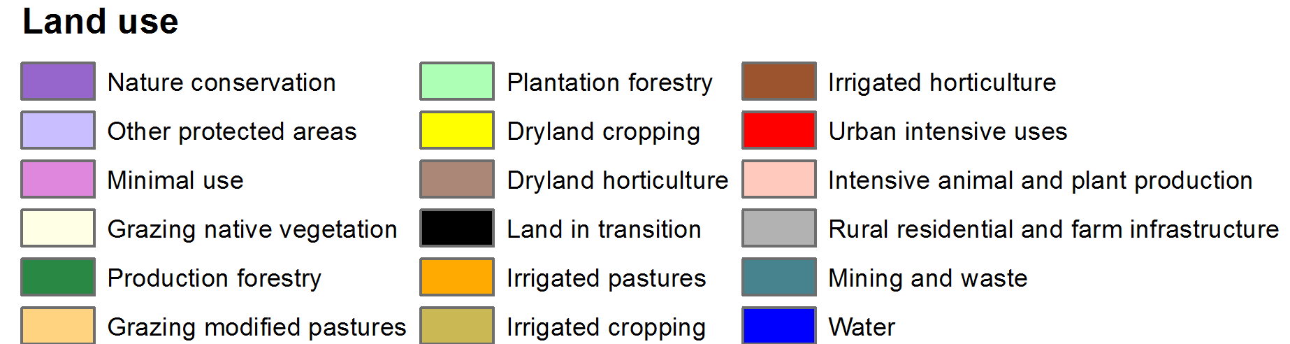 ACLUMP's land use products, left: Catchment Scale Land Use of Australia – Update December 2020, right: national scale Land Use of Australia 2010–11 to 2015–16 (click on image to link to metadata details or learn more about the different scales of land use mapping) |
| URL | 查看原文 |
| 来源平台 | Australian Bureau of Agricultural and Resource Economics and Sciences |
| 文献类型 | 科技报告 |
| 条目标识符 | http://119.78.100.173/C666/handle/2XK7JSWQ/350895 |
| 专题 | 资源环境科学 |
| 推荐引用方式 GB/T 7714 | admin. Land use of Australia 2010-11 to 2015-16,2022. |
| 条目包含的文件 | 条目无相关文件。 | |||||
| 个性服务 |
| 推荐该条目 |
| 保存到收藏夹 |
| 查看访问统计 |
| 导出为Endnote文件 |
| 谷歌学术 |
| 谷歌学术中相似的文章 |
| [admin]的文章 |
| 百度学术 |
| 百度学术中相似的文章 |
| [admin]的文章 |
| 必应学术 |
| 必应学术中相似的文章 |
| [admin]的文章 |
| 相关权益政策 |
| 暂无数据 |
| 收藏/分享 |
除非特别说明,本系统中所有内容都受版权保护,并保留所有权利。


修改评论