Global S&T Development Trend Analysis Platform of Resources and Environment
| Earth from Space: Scandinavian Peninsula | |
| admin | |
| 2022-04-15 | |
| 发布年 | 2022 |
| 语种 | 英语 |
| 国家 | 欧洲 |
| 领域 | 地球科学 |
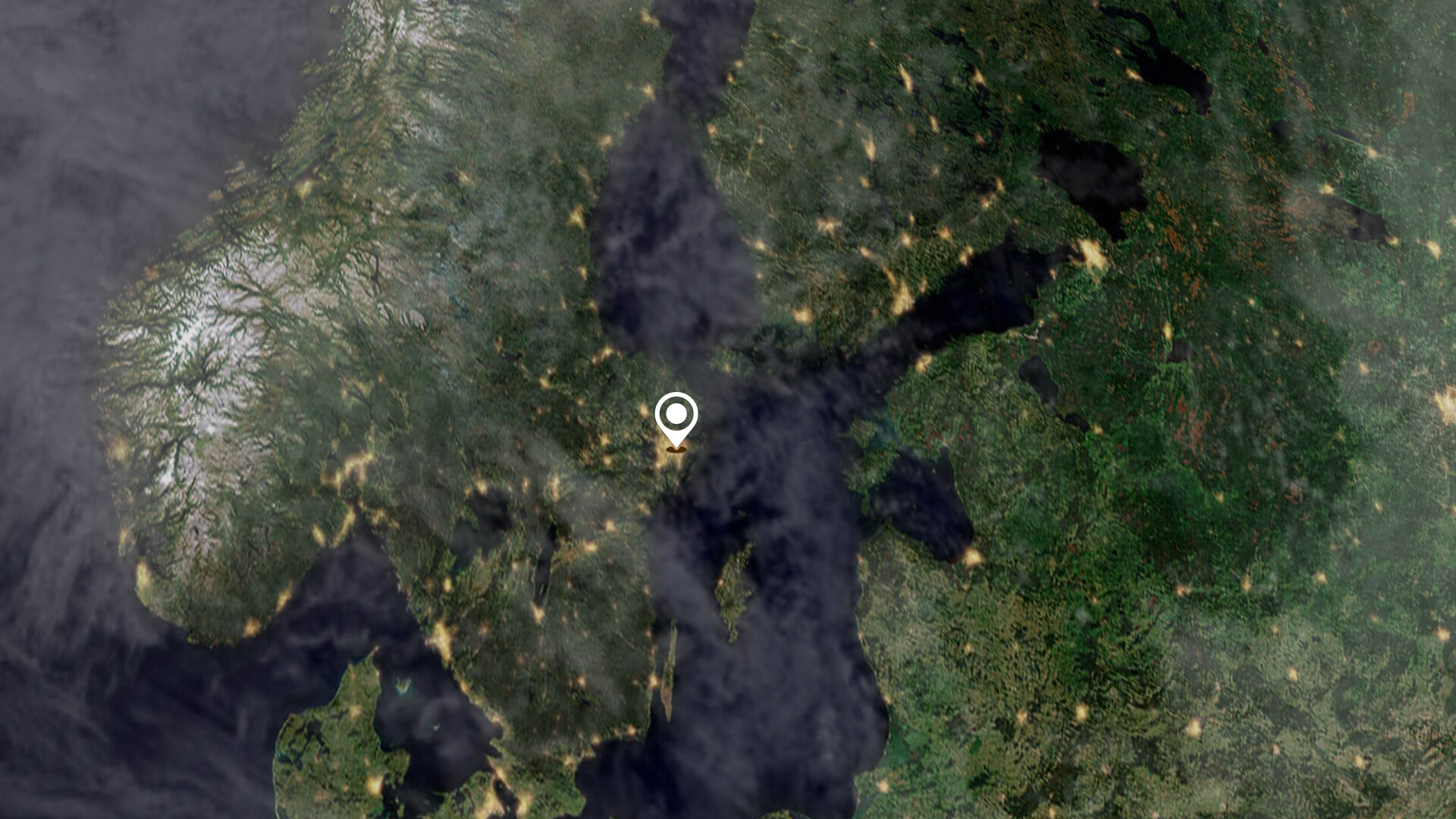
| 正文(英文) | The Copernicus Sentinel-3 mission captured this impressive shot of the almost cloud-free Scandinavian Peninsula on 20 March. Click on the image below to explore it in its full resolution. 
The Scandinavian Peninsula, which comprises Sweden and Norway, is approximately 1850 km long. It extends southward from the Barents Sea in the north, the Norwegian sea to the west and the Gulf of Bothnia and the Baltic Sea to the east. Denmark, Finland, Latvia and Lithuania are also visible in this week’s image. Along the left side of the peninsula, the jagged fjords lining Norway’s coast can be spotted from space. Many of these fjords were carved out by the thick glaciers that formed during the last ice age. The largest and deepest fjord on Norway’s coast, called Sognefjord, lies in southwest Norway and is 1308 m deep. Sweden’s topography consists mainly of flat, rolling lowlands dotted with lakes. Lake Vänern and Lake Vättern, the largest lakes of Sweden, are clearly visible at the bottom of the peninsula. The lakes do not freeze completely during the winter months. To the northeast of the peninsula lies Finland with more than 55 000 lakes – most of which were also created by glacial deposits. During March, much of northern Europe and Scandinavia had been affected by a strong high-pressure weather system, which also allowed for this almost cloud-free acquisition. On 19 March in Tirstrup, Denmark, the atmospheric pressure reached 1051.6 hPa, the highest value ever recorded in March. Carrying a suite of cutting-edge instruments, Copernicus Sentinel-3 measures Earth’s oceans, land, ice and atmosphere to monitor and understand large-scale global dynamics. It provides essential information in near-real time for ocean and weather forecasting. With a focus towards our oceans, Sentinel-3 measures the temperature, colour and height of the sea surface as well as the thickness of sea ice, while, over land, the mission maps the way land is used, provides indices of vegetation state and measures the height of rivers and lakes. A technical note: the image is a mosaic of 2 descending orbits with a difference of around 60 minutes between them, hence the observable striping at the top of the image. The image is also featured on the Earth from Space video programme. 
Earth from Space: Scandinavian Peninsula
Access the video |
| URL | 查看原文 |
| 来源平台 | European Space Agency |
| 文献类型 | 新闻 |
| 条目标识符 | http://119.78.100.173/C666/handle/2XK7JSWQ/349052 |
| 专题 | 地球科学 |
| 推荐引用方式 GB/T 7714 | admin. Earth from Space: Scandinavian Peninsula. 2022. |
| 条目包含的文件 | 条目无相关文件。 | |||||
| 个性服务 |
| 推荐该条目 |
| 保存到收藏夹 |
| 查看访问统计 |
| 导出为Endnote文件 |
| 谷歌学术 |
| 谷歌学术中相似的文章 |
| [admin]的文章 |
| 百度学术 |
| 百度学术中相似的文章 |
| [admin]的文章 |
| 必应学术 |
| 必应学术中相似的文章 |
| [admin]的文章 |
| 相关权益政策 |
| 暂无数据 |
| 收藏/分享 |
除非特别说明,本系统中所有内容都受版权保护,并保留所有权利。


修改评论