Global S&T Development Trend Analysis Platform of Resources and Environment
| Earth from Space: Snowy Pyrenees | |
| admin | |
| 2022-03-04 | |
| 发布年 | 2022 |
| 语种 | 英语 |
| 国家 | 欧洲 |
| 领域 | 地球科学 |
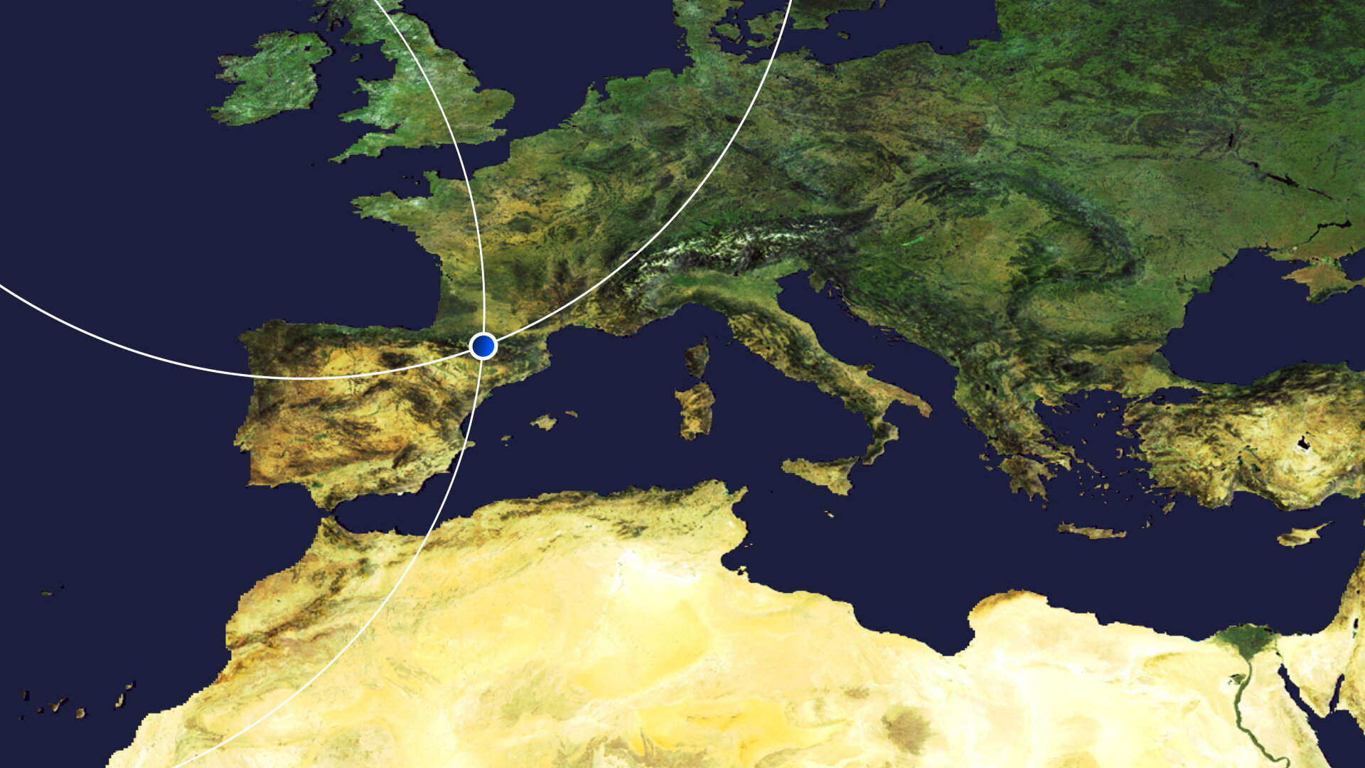
| 正文(英文) | Today, the Copernicus Sentinel-2 mission takes us over the Pyrenees Mountains in southwest Europe. The mountain range forms a natural border between France and Spain with the small, landlocked country of Andorra sandwiched in between. Click on the image below to explore it in its full 10 m resolution. 
Stretching from the shores of the Mediterranean Sea on the east to the Bay of Biscay (Atlantic Ocean) on the west, this international mountain range is 430 km long. The area pictured in this image, captured on 30 January 2022, spans around 120 km from the village of Escallare in the east to Panticosa to the west. Located in the Spanish province of Huesca in the Posets-Maladeta Natural Park lies Pico de Aneto, the highest mountain peak in the Pyrenees. It rises to an elevation of 3404 m and is also the third-highest mountain in Spain. Click on the circle in the image to take a closer look at Pico de Aneto. Geological studies have revealed that the Pyrenees Mountains have been around for longer than the Alps, with their sediments first deposited in coastal basins during the Paleozoic and Mesozoic eras. The entire mountain range formed due to the upwelling of large sedimentary rocks by the collision of the Iberian and the Eurasian plate around 100 to 150 million years ago, followed by intense erosion from ice and water. Snow covers many of the peaks year-round, especially those in the centre-section of the chain. The western Pyrenees typically receive greater precipitation than the eastern Pyrenees owing to moisture blowing in from the Atlantic Ocean. The mountain range is also home to several small glaciers, as well as many mountain lakes and some of the highest waterfalls in Europe including Gavarnie Falls which, at 422 m, is France’s highest waterfall. Few people live at the Pyrenees’ highest elevations; however, Andorra is nestled among peaks near the eastern end of the chain (not visible in the image). With an area of around 468 sq km, Andorra is the sixth smallest country in Europe. The Copernicus Sentinel-2 mission is designed to play a key role in mapping differences in land cover to understand the landscape, map how it is used and monitor changes over time. As well as providing detailed information about Earth’s vegetation, it can also systematically map different classes of cover such as forest, grassland, water surfaces and artificial cover like roads and buildings. This image is also featured on the Earth from Space video programme. 
Earth from Space: Snowy Pyrenees
Access the video |
| URL | 查看原文 |
| 来源平台 | European Space Agency |
| 文献类型 | 新闻 |
| 条目标识符 | http://119.78.100.173/C666/handle/2XK7JSWQ/347234 |
| 专题 | 地球科学 |
| 推荐引用方式 GB/T 7714 | admin. Earth from Space: Snowy Pyrenees. 2022. |
| 条目包含的文件 | 条目无相关文件。 | |||||
| 个性服务 |
| 推荐该条目 |
| 保存到收藏夹 |
| 查看访问统计 |
| 导出为Endnote文件 |
| 谷歌学术 |
| 谷歌学术中相似的文章 |
| [admin]的文章 |
| 百度学术 |
| 百度学术中相似的文章 |
| [admin]的文章 |
| 必应学术 |
| 必应学术中相似的文章 |
| [admin]的文章 |
| 相关权益政策 |
| 暂无数据 |
| 收藏/分享 |
除非特别说明,本系统中所有内容都受版权保护,并保留所有权利。


修改评论