Global S&T Development Trend Analysis Platform of Resources and Environment
| Sentinel-6 returning most precise data ever on sea level | |
| admin | |
| 2021-11-29 | |
| 发布年 | 2021 |
| 语种 | 英语 |
| 国家 | 欧洲 |
| 领域 | 地球科学 |
| 正文(英文) | Sea-level rise is one of the most immediate consequences of climate change, as highlighted recently through urgent pleas from leaders of island nations at the COP26 summit. Global measures of sea-level rise are imperative to underpinning global policy and for strategies to protect coastlines and low-lying lands. Measuring tiny differences in the height of the sea surface from space is no easy task – but that’s exactly what the Copernicus Sentinel-6 Michael Freilich satellite is doing. And, after a year of exhaustive testing, this new mission is now delivering the world’s most accurate data on sea-level rise. Launched on 21 November 2020, Copernicus Sentinel-6 Michael Freilich uses the latest radar altimetry technology, developed by ESA, to advance the long-term record of sea-surface height measurements that began in 1992 by the French–US Topex-Poseidon satellite and that were followed by the Jason series of satellite missions. With the importance of monitoring sea-level rise so high on the global agenda, numerous organisations have been involved in making Copernicus Sentinel-6 the gold standard reference mission to take the record of sea-surface height measurements into the future, and to do this with greater precision than ever before. So while Sentinel-6 is one of the European Union’s family of Copernicus missions, its implementation is the result of an exceptional cooperation between the European Commission ESA, Eumetsat, NASA and NOAA, with support from the CNES French space agency. Eumetsat – the European Organisation for the Exploitation of Meteorological Satellites, is responsible for operating the satellite and for making the data available to users. The first data products, which were low-resolution products, were released in June. This was an important step in the transition to the higher-resolution products being released today. The data have been used for weather forecasting and seasonal forecasting models, and to forecast the development and track of hurricanes. Sentinel-6’s Poseidon-4 altimeter was designed to bring new high-resolution Ku-band synthetic aperture radar measurements into the altimetry reference time series. It, therefore, delivers simultaneous low-resolution measurements and high-resolution measurements. The low-resolution measurements are matched with measurements from the mission’s predecessor, Jason-3, and, therefore, critical to ensuring continuity, and the enhanced high-resolution data can then be offered with absolute confidence. 
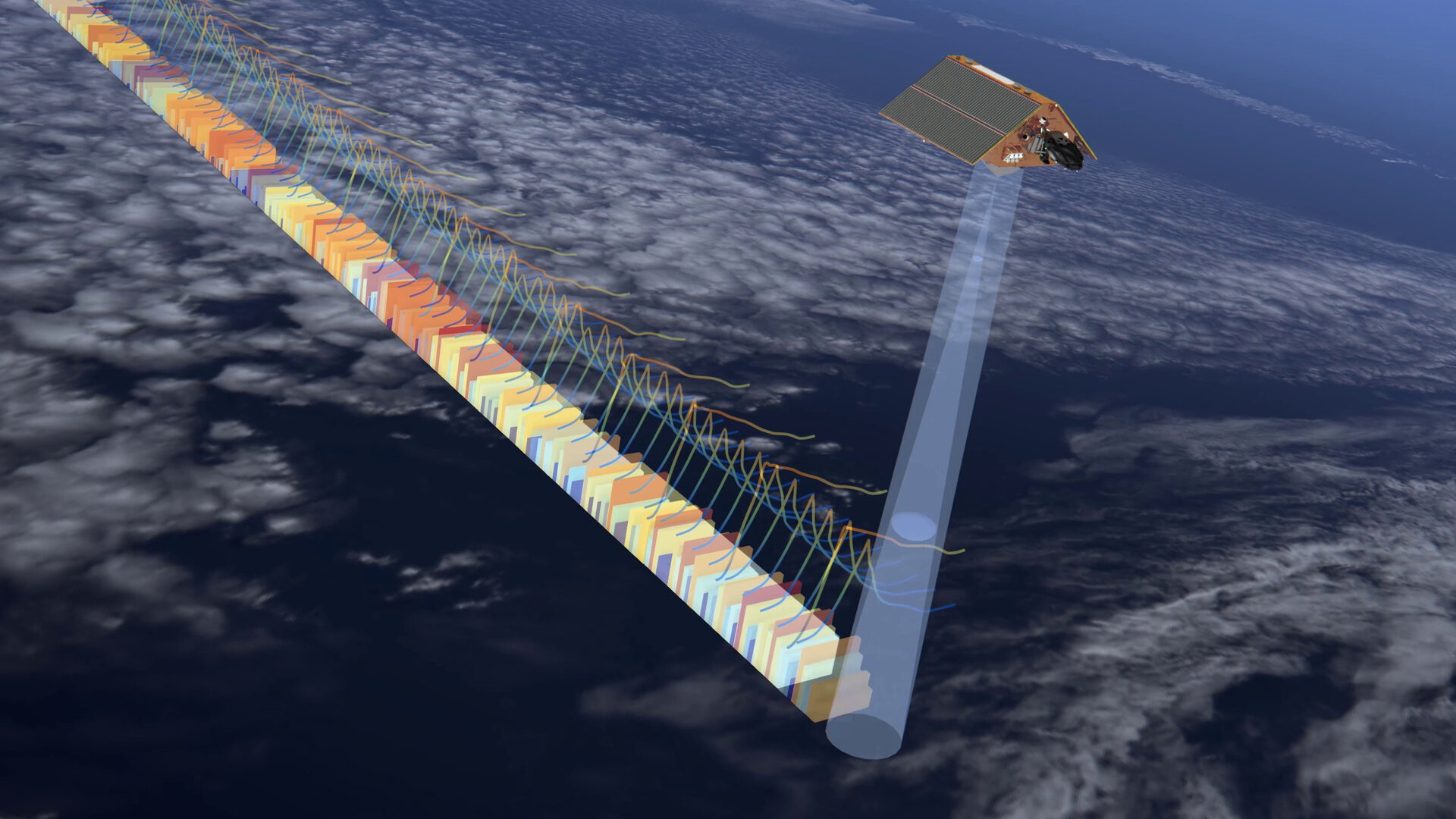
Copernicus Sentinel-6 in action
Access the video To make sure that differences between the historical low-resolution time series and the new data from Copernicus Sentinel-6 Michael Freilich are fully understood, a 12-month tandem flight has been taking place. This involves Sentinel-6 flying 30 seconds behind its predecessor satellite, Jason-3, following the same ground track. Following months of careful testing, the stream of Copernicus Sentinel-6 high-resolution data are now available. Eumetsat’s ocean altimetry programme manager, Julia Figa Saldana, said, “Experts from around the globe have closely examined and validated the data, confirming that the Copernicus Sentinel-6 mission is robust, precise and highly reliable. By cross-calibrating Sentinel-6 against its predecessor Jason-3 to within 1 mm, we ensure that the 30-year record of mean sea level, as captured by satellite radar altimeters, continues uninterrupted. “The data released today is critical for monitoring the impact of climate change on Earth’s oceans.” ESA’s Sentinel-6 mission scientist, Craig Donlon, added, “Measurements of sea-level rise provide a unique but integrated view of climate change since a warming ocean expands and increased melting of ice on land both lead to an increase in sea level. “Sentinel-6 Michael Freilich securely brings a new synthetic aperture radar measurement technique into the reference altimeter time series for the first time. This allows Sentinel-6 to provide improved sea state and wind speed measurements, enhanced capabilities for river and lake hydrology applications while maintaining the stability of sea-level rise estimates. These measurements provide evidence that is critical to develop and implement robust societal policy for our future.”
ESA’s Copernicus Sentinel-6 project manager, Pierrik Vuilleumier, noted, “The collaboration with NASA, EUMETSAT, NOAA and CNES has, today, come to fruition with the timely release of mission products to operational users, providing both continuity with previous reference missions and new high-resolution synthetic aperture radar products. The Poseidon-4 altimeter’s digital technology brings unprecedented level of performance.” “While Sentinel-6 Michael Freilich is exceeding expectations in orbit, we are busy with its follow on, Sentinel-6B. The satellite is now at IABG’s facilities in Ottobrunn, Germany, undergoing an environmental test campaign that will run through until next March. In the middle of the year it will be put into storage until we prepare it for launch at the end of 2025.” |
| URL | 查看原文 |
| 来源平台 | European Space Agency |
| 文献类型 | 新闻 |
| 条目标识符 | http://119.78.100.173/C666/handle/2XK7JSWQ/342222 |
| 专题 | 地球科学 |
| 推荐引用方式 GB/T 7714 | admin. Sentinel-6 returning most precise data ever on sea level. 2021. |
| 条目包含的文件 | 条目无相关文件。 | |||||
| 个性服务 |
| 推荐该条目 |
| 保存到收藏夹 |
| 查看访问统计 |
| 导出为Endnote文件 |
| 谷歌学术 |
| 谷歌学术中相似的文章 |
| [admin]的文章 |
| 百度学术 |
| 百度学术中相似的文章 |
| [admin]的文章 |
| 必应学术 |
| 必应学术中相似的文章 |
| [admin]的文章 |
| 相关权益政策 |
| 暂无数据 |
| 收藏/分享 |
除非特别说明,本系统中所有内容都受版权保护,并保留所有权利。


修改评论