Global S&T Development Trend Analysis Platform of Resources and Environment
| Earth from Space: Tana River | |
| admin | |
| 2021-06-18 | |
| 发布年 | 2021 |
| 语种 | 英语 |
| 国家 | 欧洲 |
| 领域 | 地球科学 |
| 正文(英文) | The Tana River, Kenya’s longest river, is featured in this false-colour image captured by the Copernicus Sentinel-2 mission. Click on the image to explore it in its full 10 m resolution and learn about the features in this stunning landscape. 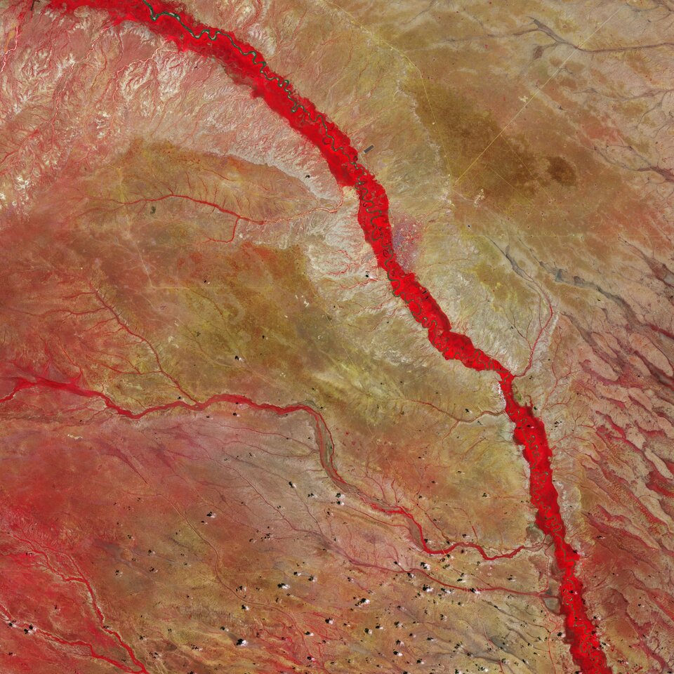
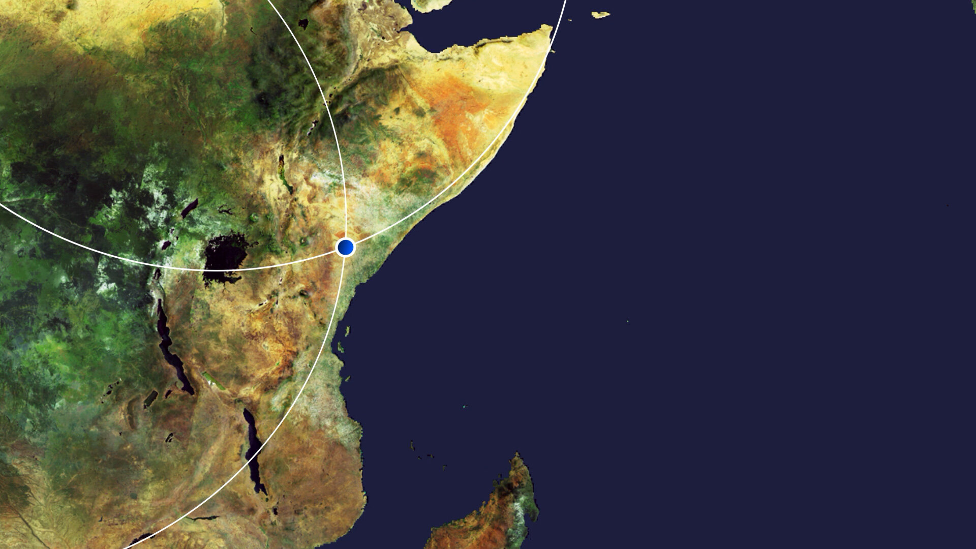
The Tana River flows for around 1000 km from the Aberdare Mountains, west of Nyeri, running eastwards before veering south around the massif of Mount Kenya, and opening onto a wide valley, pictured here, where it meanders through a floodplain often subject to inundation. The river then continues its journey before entering the Indian Ocean at Formosa Bay, Kipini. The river is known for its extraordinary biodiversity, as it provides water and life for wild animals, nomads and their livestock, as well as for agricultural purposes. Some of the Tana’s tributaries as well as several smaller, seasonal rivers, known as lagas, that only flow during the rainy season, are visible flowing in an east-west direction in the image. The river beds support livestock and wildlife during the dry season owing to their ability to retain water. This false-colour image, captured on 25 February 2020, was processed in a way that included the near-infrared channel. This type of band combination from Copernicus Sentinel-2 is most commonly used to assess plant density and health, as plants reflect near-infrared and green light, while absorbing red. Since they reflect more near-infrared than green, dense, plant-covered land appears in bright red. It is easy to pick out the narrow band of riparian forest visible along the banks of the river in the image. The riparian forest usually thrives year-round, although its extent is highly dependent on seasonal flooding and ground water recharge by the Tana. This image was captured during the area’s wet season, where the small tributaries of the Tana are highly visible and a significant amount of vegetation can be seen. If the image had been captured during the dry season (around June-September), the smaller tributaries and the vegetation growing around them would have dried up. The river flows alongside the town of Garissa, the capital of Garissa County, and is visible as a greyish patch of land on the east side of the river. Around 5 km south of Garissa lies the Bour-Algi Giraffe Sanctuary, home to around 1000 giraffes and endangered wildlife including the Rothschild giraffe and gerenuk – a long-necked antelope found in the region. Copernicus Sentinel-2 is a two-satellite mission. Each satellite carries a high-resolution camera that images Earth’s surface in 13 spectral bands. The mission is mostly used to track changes in the way land is being used and to monitor the health of vegetation. This image is also featured on the Earth from Space video programme. 
Earth from Space: Tana River
Access the video |
| URL | 查看原文 |
| 来源平台 | European Space Agency |
| 文献类型 | 新闻 |
| 条目标识符 | http://119.78.100.173/C666/handle/2XK7JSWQ/330419 |
| 专题 | 地球科学 |
| 推荐引用方式 GB/T 7714 | admin. Earth from Space: Tana River. 2021. |
| 条目包含的文件 | 条目无相关文件。 | |||||
| 个性服务 |
| 推荐该条目 |
| 保存到收藏夹 |
| 查看访问统计 |
| 导出为Endnote文件 |
| 谷歌学术 |
| 谷歌学术中相似的文章 |
| [admin]的文章 |
| 百度学术 |
| 百度学术中相似的文章 |
| [admin]的文章 |
| 必应学术 |
| 必应学术中相似的文章 |
| [admin]的文章 |
| 相关权益政策 |
| 暂无数据 |
| 收藏/分享 |
除非特别说明,本系统中所有内容都受版权保护,并保留所有权利。


修改评论