Global S&T Development Trend Analysis Platform of Resources and Environment
| US-European ocean monitoring satellite launches into orbit | |
| admin | |
| 2020-11-21 | |
| 发布年 | 2020 |
| 语种 | 英语 |
| 国家 | 美国 |
| 领域 | 气候变化 |
| 正文(英文) | VANDENBERG AIR FORCE BASE, Calif. (AP) — A U.S.-European satellite designed to extend a decades-long measurement of global sea surface heights was launched into Earth orbit from California on Saturday. A SpaceX Falcon 9 rocket carrying the satellite blasted off from Vandenberg Air Force Base at 9:17 a.m. and arced southward over the Pacific Ocean. The Falcon’s first stage flew back to the launch site and landed for reuse. The Sentinel-6 Michael Freilich satellite was released from the second stage about an hour later. It then deployed its solar panels and made first contact with controllers. Named for a former NASA official who had a key role in developing space-based oceanography, the satellite’s main instrument is an extremely accurate radar altimeter that will bounce energy off the sea surface as it sweeps over Earth’s oceans. An identical twin, Sentinel-6B, will be launched in 2025 to ensure continuity of the record. ADVERTISEMENT Space-based sea level measurements have been uninterrupted since the 1992 launch of the U.S.-French satellite TOPEX-Poseidon, which was followed by a series of satellites including the current Jason-3. Sea surface heights are affected by heating and cooling of water, allowing scientist to use the altimeter data to detect such weather-influencing conditions as the warm El Nino and the cool La Nina.  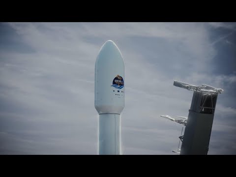 The measurements are also important for understanding overall sea level rise due to global warming that scientists warn is a risk to the world’s coastlines and billions of people. “Our Earth is a system of intricately connected dynamics between land, ocean, ice, atmosphere and also of course our human communities, and that system is changing,” Karen St. Germain, NASA’s Earth Science Division director, said in a pre-launch briefing Friday. “Because 70% of the Earth’s surface is ocean, the oceans play an enormous role in how the whole system changes,” she said. The new satellite is expected to have unprecedented accuracy. “This is an extremely important parameter for climate monitoring,” Josef Aschbacher, the European Space Agency’s director of Earth observation, told The Associated Press this week. “We know that sea level is rising,” Aschbacher said. The big question is, by how much, how quickly. Other instruments on board will measure how radio signals pass through the atmosphere, providing data on atmospheric temperature and humidity that can help improve global weather forecasts. Europe and the United States are sharing the $1.1 billion (900 million euro) cost of the mission, which includes the twin satellite. ____ Associated Press journalist Frank Jordans contributed to this report from Berlin. |
| URL | 查看原文 |
| 来源平台 | The Associated Press |
| 文献类型 | 新闻 |
| 条目标识符 | http://119.78.100.173/C666/handle/2XK7JSWQ/310319 |
| 专题 | 气候变化 |
| 推荐引用方式 GB/T 7714 | admin. US-European ocean monitoring satellite launches into orbit. 2020. |
| 条目包含的文件 | 条目无相关文件。 | |||||
| 个性服务 |
| 推荐该条目 |
| 保存到收藏夹 |
| 查看访问统计 |
| 导出为Endnote文件 |
| 谷歌学术 |
| 谷歌学术中相似的文章 |
| [admin]的文章 |
| 百度学术 |
| 百度学术中相似的文章 |
| [admin]的文章 |
| 必应学术 |
| 必应学术中相似的文章 |
| [admin]的文章 |
| 相关权益政策 |
| 暂无数据 |
| 收藏/分享 |
除非特别说明,本系统中所有内容都受版权保护,并保留所有权利。


修改评论